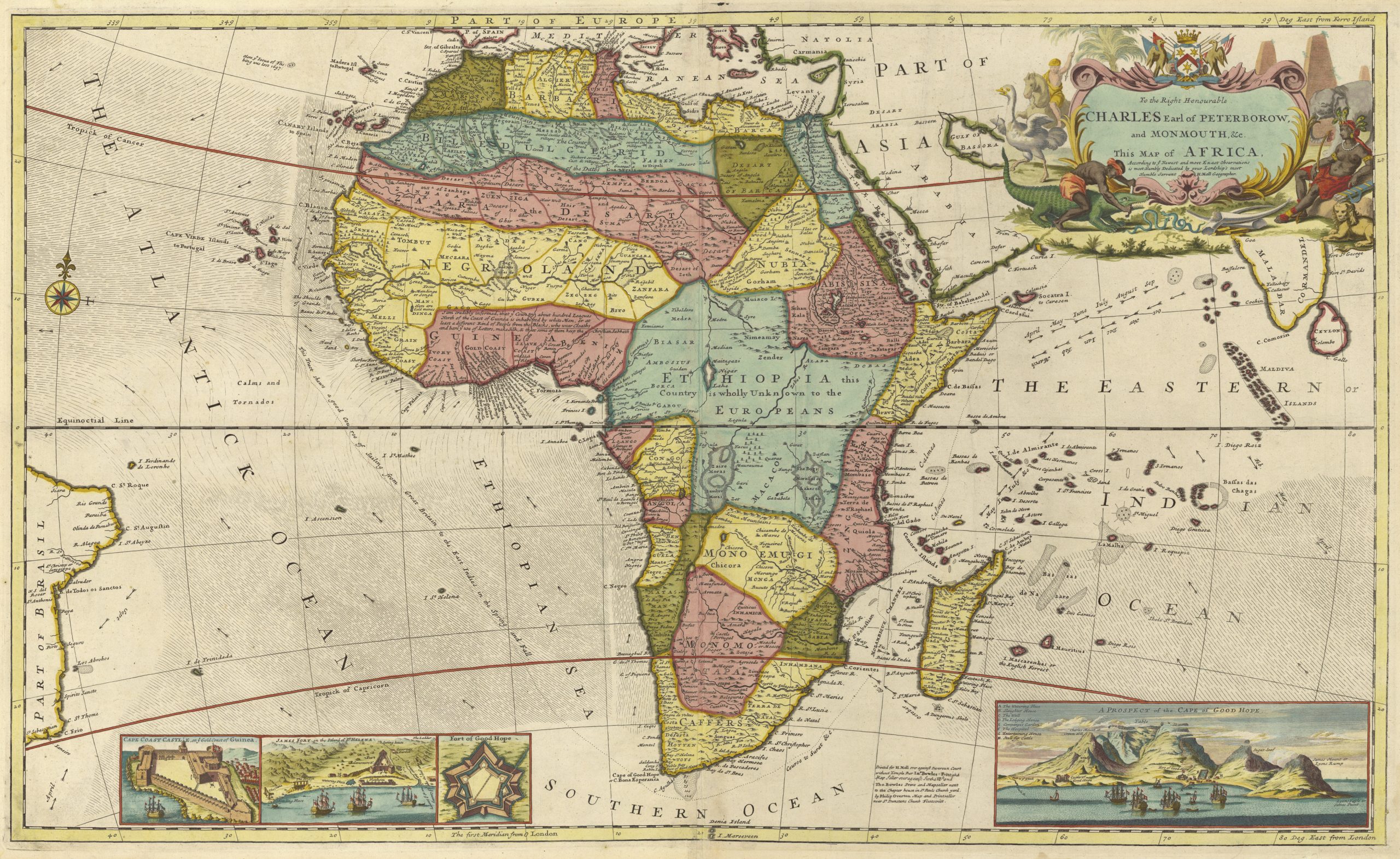
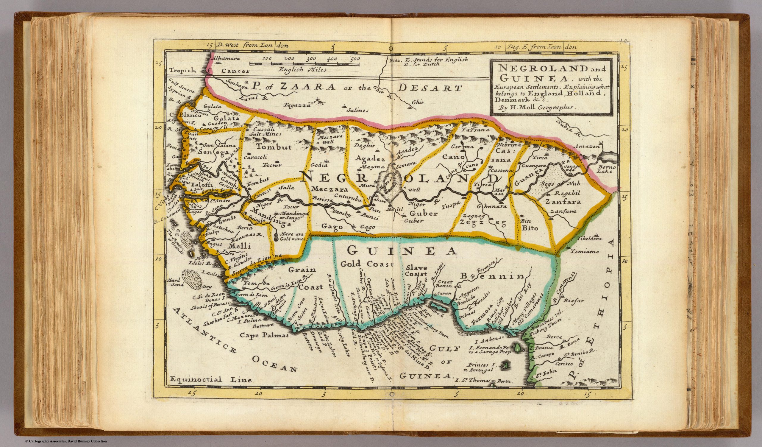
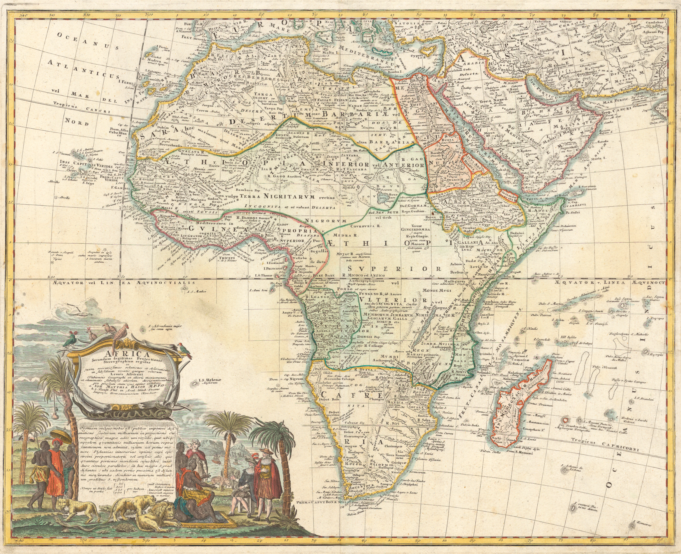
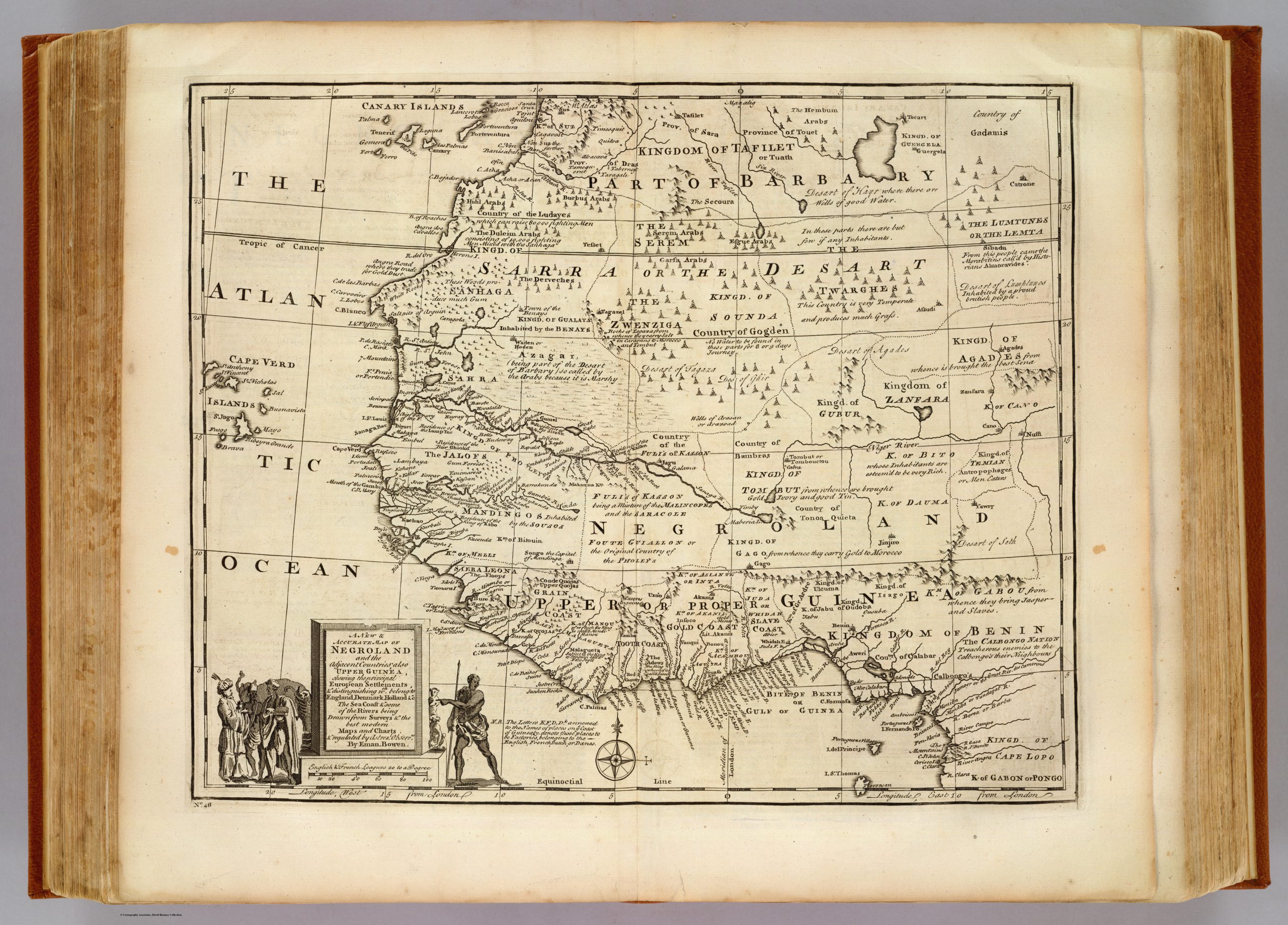
In Part 6 of my Docs Series, when discussing who the people labeled as “Black People” truly are, I discussed the European Slavers maps of Africa that they used when they were gathering their slaves. These maps are an important tool that can be used for your own research so I wanted to share them with everyone who desires to do more research. Just click each image and you can save them. I hope this helps your studies!
Click Image to Download
Click Image to Download
Click Image to Download
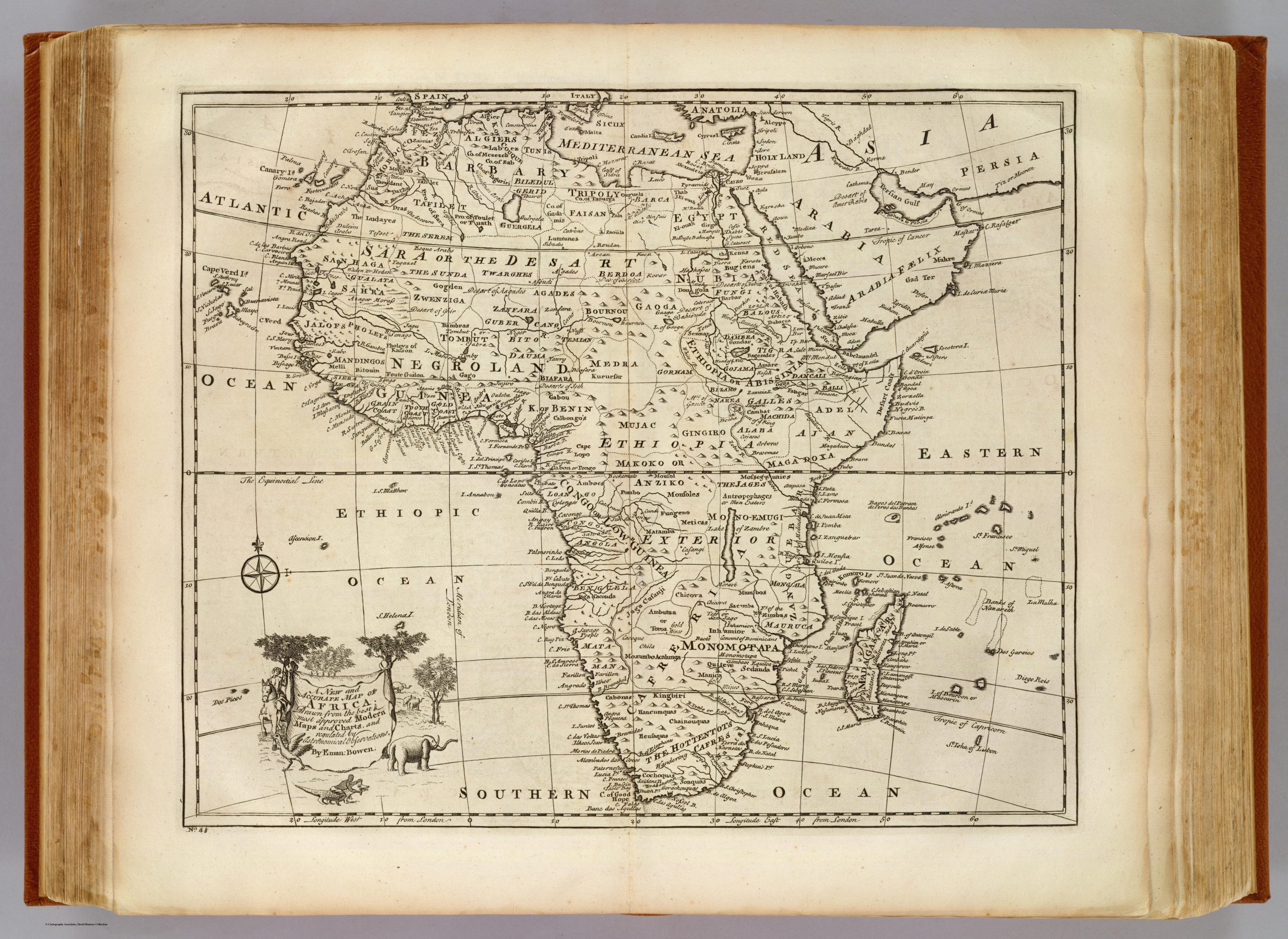
Eman Bowen – 1747 (Full map)
Click Image to Download
Click Image to Download